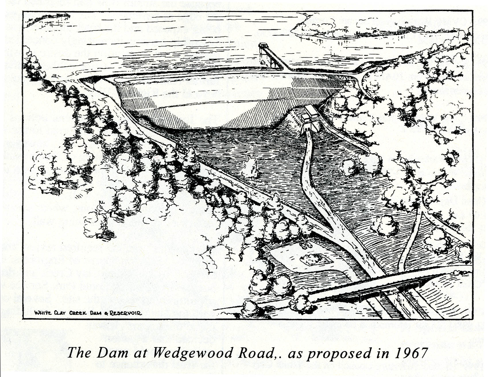
State legislation in the 1960s gave New Castle County authority to establish a water supply and flood control system in the White Clay Creek Watershed and to acquire land to be held in the name of the State of Delaware for the use of New Castle County. Even earlier, E. I. du Pont de Nemours had been actively purchasing lands in Delaware and Pennsylvania in anticipation of water needs to support growth of its Newport and Edge Moor Plants. New Castle County proposed to use DuPont Company land holdings as the site for construction of a reservoir and dam project. The earth dam with concrete spillway, 1200 feet wide and 100 feet high, was to be located at Wedgewood Road, which runs across Rte 896 and through White Clay Creek State Park. The proposed reservoir would have flooded 1160 acres, 560 in Delaware and 600 in Pennsylvania.
Items on display in Library exhibit:
1. Delaware Department of Natural Resources and Environmental Control, State of Delaware water resources framework (report), 1970
2. The Committee of 100, Action is needed to assure an adequate supply of water in New Castle County, 1973 March
3. Newark (Delaware) Planning Department and Department of Parks and Recreation, Christina River Stream Valley: guidelines for acquisition and financing (report), 1973 January (William J. Cohen papers, University of Delaware Library)
4. The Dam at Wedgewood Road as proposed in 1967 (illustration) from “The Early Years of White Clay Watershed Association” by David R. Hawk in WCWA News, 1999 Autumn
5. University of Delaware Division of Urban Affairs, The economic and engineering feasibility of a unified water system for northern New Castle County, Delaware, prepared by Marvin R. Brams, Charles Chandler, and Nancy Wilson, 1969 February


